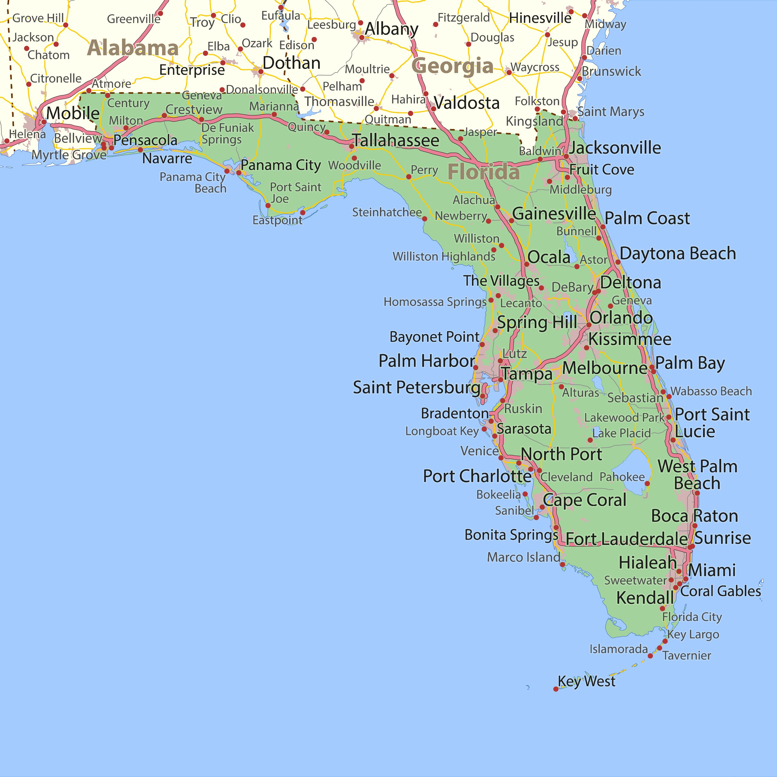
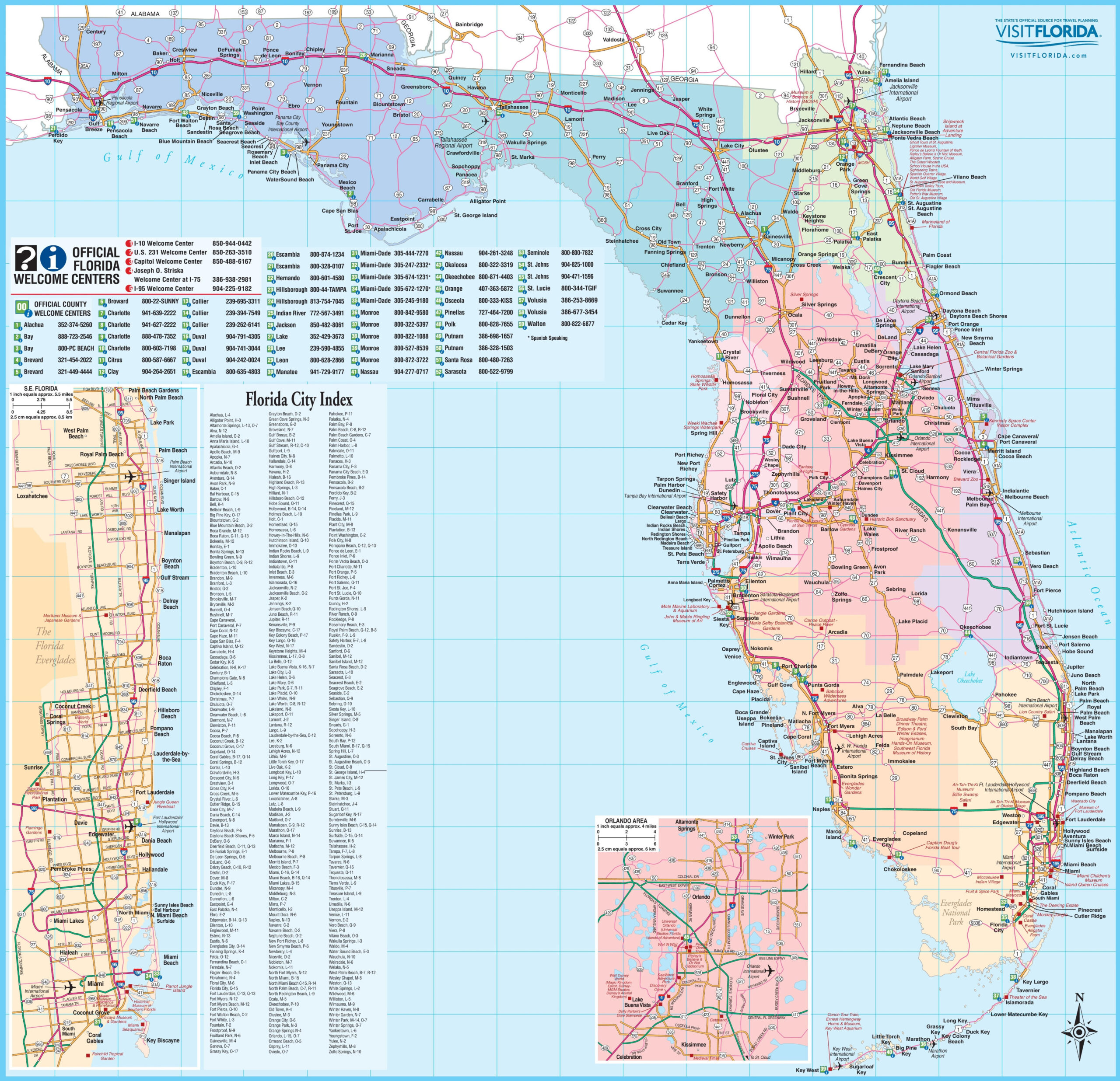
Detailed Map of West Coast of Florida
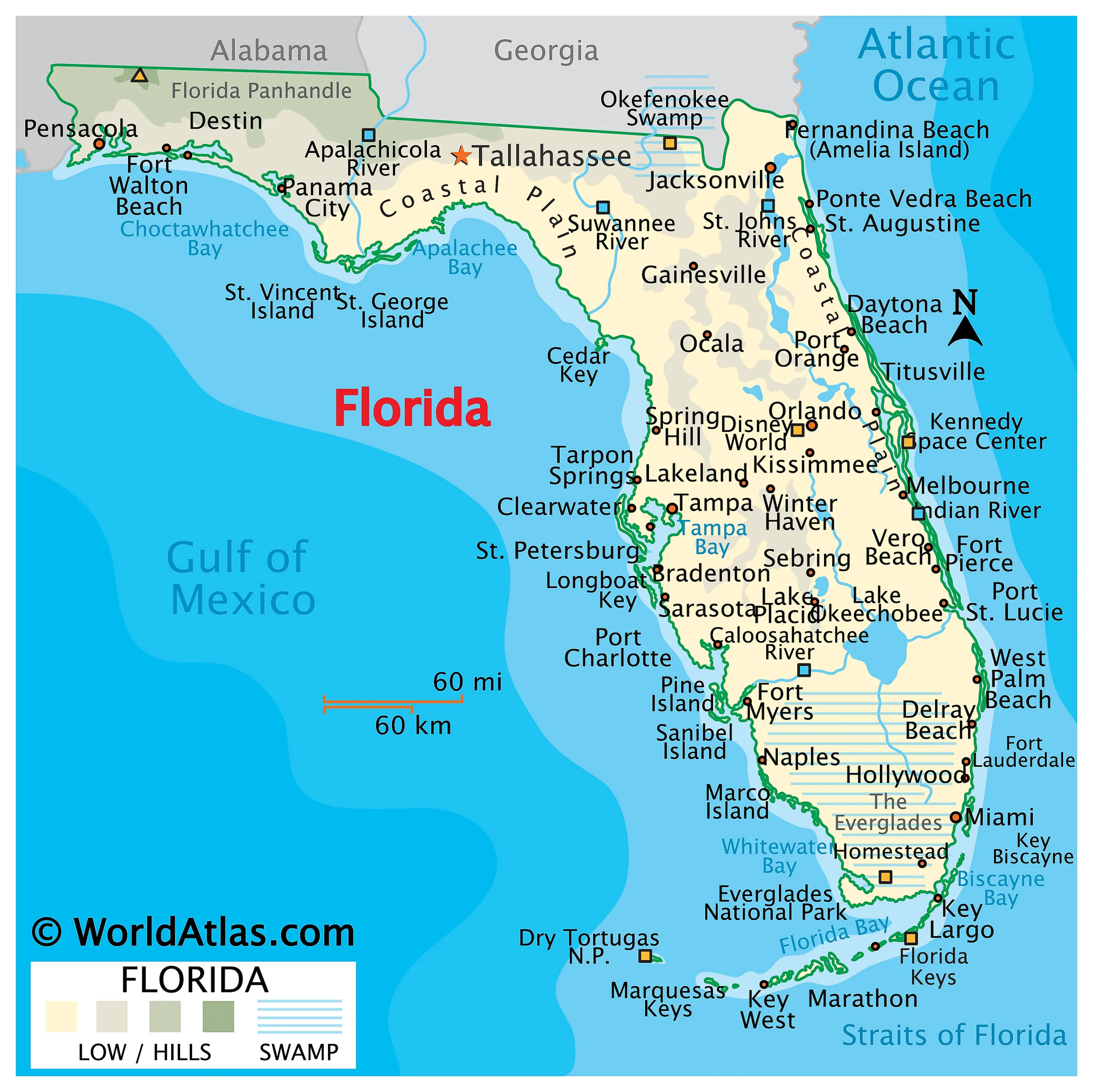
Beach Map | Detailed Map of West Coast of Florida – Florida’s West Coast is full of hidden gems waiting to be discovered. From the bustling city of Tampa to the quaint coastal town of Cedar Key, there is something for everyone along this stretch of coastline. With the help of a West Coast of … Read more